Cloud Exploration: How to spot altocumulus clouds
What to look for and what they mean for your weather
BOWLING GREEN, Ky. (WBKO) - We’re launching a brand-new weather series to help you understand the clouds above your head and what they’re trying to tell you. This week, we’re starting with altocumulus clouds, and we think you’ll love spotting them once you know what to look for.
What Do Altocumulus Clouds Look Like?
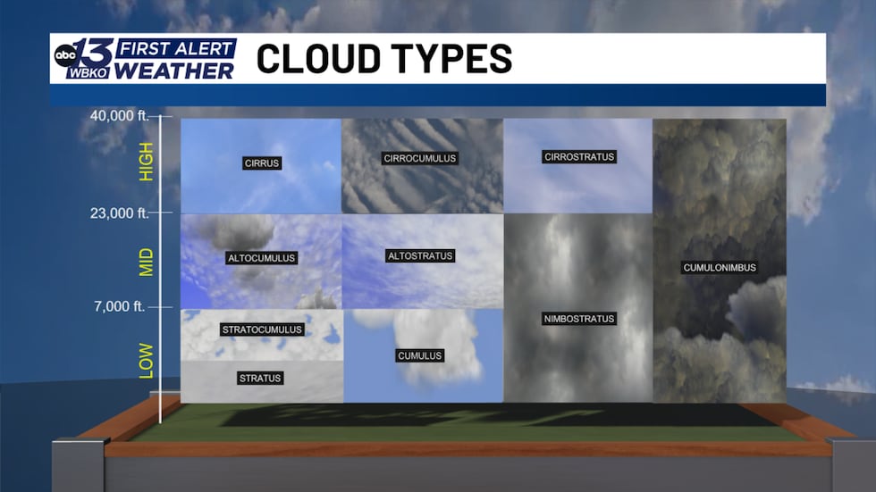
Altocumulus clouds float in the middle layers of the troposphere and look like thin, sheet-like layers of small, grayish-white rolls or patches. Think of them as a fluffy blanket stretched across the sky. Once you spot one, you’ll start seeing them everywhere.
What Do They Mean for Your Weather?
These clouds are like nature’s weather forecast. When you see altocumulus clouds, warmer temperatures are often on the way, as they frequently show up ahead of warm fronts moving into your area.
They can also signal that storms may develop later in the day. Their presence means there’s mid-level instability in the atmosphere, which can fuel storm development as the day heats up.
Help Us Track the Clouds
We want to see the different clouds in your area. If you spot an interesting cloud or even just think they’re pretty, snap a photo and send them our way at wbko.com/photos. Your photos may just appear on air as we continue this cloud series!

Copyright 2026 WBKO. All rights reserved.