Understanding lifting mechanisms: How cold fronts generate storms
BOWLING GREEN, Ky. (WBKO) - When our First Alert Weather team forecast thunderstorms, they’re not just making educated guesses. Understanding how these lifting mechanisms work can help you better understand why we issue weather alerts and how we predict severe weather.
Let’s explore the four main ways air is forced upward in the atmosphere and how each one triggers storm development.
What Is Lifting?
Lifting is when air is forced upward in the atmosphere. This is crucial for storm development because as air rises, it cools down. When air cools, the moisture in it condenses into clouds. And under the right conditions, those clouds become thunderstorms.
There are four main lifting mechanisms that meteorologists watch for:
FRONTAL LIFTING
Frontal lifting is what we experienced today in Bowling Green, and it’s one of the most common lifting mechanisms during seasonal transitions.
How It Works
A cold front is a boundary where cold air is actively replacing warm air. When a cold front moves into an area, the cold air acts like a wedge — it slides underneath the warm, moist air and forces it upward and out of the way.
As that warm air is lifted higher into the atmosphere, it cools down. The moisture in the air condenses, creating clouds. If there’s enough instability and moisture in the atmosphere, those clouds develop into thunderstorms.
Why It’s Common in Fall
During the fall season, we transition from hot summer air to cold winter air. This creates strong boundaries — cold fronts — that move through our area regularly. When these fronts arrive, they collide with the warm, moist air that’s still lingering from summer. That collision triggers lifting, and storms often develop right along the front.
Today’s Example
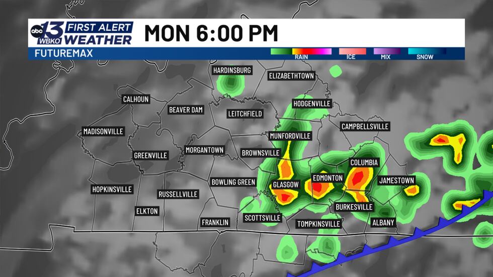
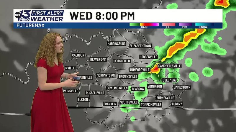
This morning, we had a cold front positioned near the Ohio River. Throughout the day, that front moved slowly southward toward Bowling Green. By late afternoon and early evening, the front reached our area. As the cold air pushed in, it forced the warm, moist air that had been sitting over us to lift upward. Right along that boundary, scattered thunderstorms developed.
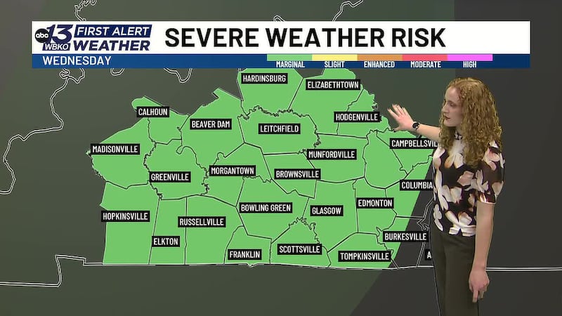
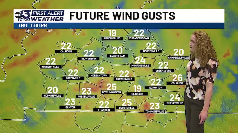
The main threat from these frontal storms was gusty winds — which is typical when you have a strong cold front combined with plenty of moisture in the air and strong wind shear.
CONVECTIVE LIFTING
Convective lifting is the classic summer thunderstorm mechanism and is driven by daytime heating.
How It Works
During the day, the sun heats the ground. That heat warms the air near the surface, making it less dense. Warm air bubbles rise on their own — they don’t need anything to force them up. As these warm air parcels rise, they cool, moisture condenses, and clouds form.
If the atmosphere is unstable enough (meaning warm air near the surface and cold air aloft), those clouds can develop into thunderstorms.
When It’s Most Active
Convective lifting is strongest during the afternoon and early evening when the sun is most intense. This is why summer thunderstorms often develop in the late afternoon — the ground has had all day to heat up, and the rising air parcels trigger storm development.
Real-World Example
On a hot, humid summer day, you might notice thunderstorms popping up around 3 or 4 p.m., even if there’s no front or other weather system moving through. That’s convective lifting. The intense daytime heating is doing all the work.
Why It’s Different From Frontal Lifting
With convective lifting, the storms are scattered and develop more randomly across the area. With frontal lifting, storms develop in a more organized line along the front, making them more predictable and easier to track.
CONVECTIVE LIFTING
Convective lifting is the classic summer thunderstorm mechanism and is driven by daytime heating.
How It Works
During the day, the sun heats the ground. That heat warms the air near the surface, making it less dense. Warm air bubbles rise on their own — they don’t need anything to force them up. As these warm air parcels rise, they cool, moisture condenses, and clouds form.
If the atmosphere is unstable enough (meaning warm air near the surface and cold air aloft), those clouds can develop into thunderstorms.
When It’s Most Active
Convective lifting is strongest during the afternoon and early evening when the sun is most intense. This is why summer thunderstorms often develop in the late afternoon — the ground has had all day to heat up, and the rising air parcels trigger storm development.
Real-World Example
On a hot, humid summer day, you might notice thunderstorms popping up around 3 or 4 p.m., even if there’s no front or other weather system moving through. That’s convective lifting. The intense daytime heating is doing all the work.
Why It’s Different From Frontal Lifting
With convective lifting, the storms are scattered and develop more randomly across the area. With frontal lifting, storms develop in a more organized line along the front, making them more predictable and easier to track.
CONVERGENCE LIFTING
Convergence lifting occurs when two air masses collide and are forced to rise because they have nowhere else to go.
How It Works
Imagine two winds blowing toward each other. When they meet, the air can’t flow horizontally anymore — it has to go up. This upward motion is convergence lifting.
Where You See It Most
The best example of convergence lifting happens in Florida, where sea breezes collide. During the day, the land heats up faster than the ocean. This creates a pressure difference that causes winds to blow from the ocean toward the land (sea breeze). On the east coast and west coast of Florida, these sea breezes blow toward each other. When they collide inland, the air is forced upward, triggering thunderstorms.
Other Examples
Convergence lifting can also occur where low-pressure and high-pressure wind patterns meet, or where different wind flows collide at upper levels of the atmosphere.
OROGRAPHIC LIFTING
Orographic lifting occurs when air is forced upward over mountains and elevated terrain.
How It Works
Imagine wind blowing toward a mountain range. The air has nowhere to go but up. As it rises over the mountain, it cools, moisture condenses, and clouds and precipitation develop on the windward side of the mountain.
Where You See It
You won’t see much orographic lifting here in Kentucky, but it’s very common in areas near mountain ranges. The Appalachian Mountains in Virginia and the Carolinas experience this regularly. Coastal states near the Rockies also see frequent orographic lifting, especially when moist air from the Pacific Ocean is forced up and over the mountain ridges.
Real-World Example
If you’ve ever noticed that one side of a mountain gets much more rain than the other side, that’s orographic lifting at work. The windward side (facing the wind) gets the rain, while the leeward side (sheltered from the wind) stays drier. This creates what meteorologists call a “rain shadow.”
Why Understanding Lifting Matters
Each of these lifting mechanisms plays a role in storm development. As meteorologists, we constantly monitor which lifting mechanisms are in play because it helps us predict where and when storms will develop.
Today in Bowling Green, frontal lifting was the dominant mechanism. We knew a cold front was moving through, we knew there was warm, moist air in place, and we knew the front would force that air upward.
Understanding these mechanisms also helps us explain to you why we’re calling for storms. It’s not just a guess — it’s based on the physics of how the atmosphere works.
What’s Next?
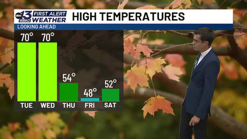
Now that the cold front has passed through Bowling Green, the cold air is taking over. Tonight and tomorrow, you’ll notice a significant change in how the weather feels. Temperatures will drop, humidity will decrease, and conditions will be much more pleasant. Just in time for the first day of Fall!
This is a perfect example of how fall weather works. Those seasonal transitions bring strong frontal systems that can trigger storms. As we head deeper into fall and winter, frontal lifting will become even more common as the temperature contrast between air masses increases.
DOWNLOAD the WBKO First Alert Weather App for the latest on the forecast. Our app is easy to use and free to download!
Click one of the following links to download the app:
Copyright 2026 WBKO. All rights reserved.