Storms heading to the region tonight
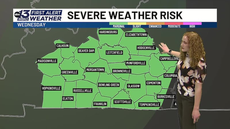
Possible severe storms impact Kentucky this evening
BOWLING GREEN, Ky. (WBKO) - We have another chilly morning with temperatures dipping down into the 30s, but we’ll start to warm up through the morning for a warm afternoon. Clouds begin to roll in this afternoon as a cold front heads across the region.
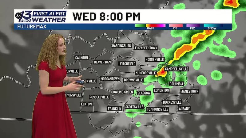
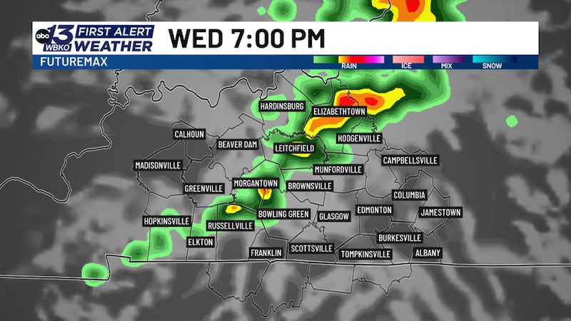
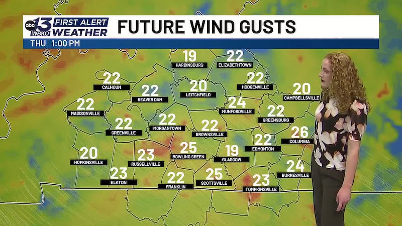
SEVERE STORMS TONIGHT: Storm chances return to the region as a low-pressure system moves across the Midwest. We’ll see a line of rain with scattered storms between 4-10pm tonight. The overall severe threat is low, but storms that strengthen enough could bring localized wind gusts and downpours, and we can’t rule out the possibility of small hail or a brief spin-up tornado.
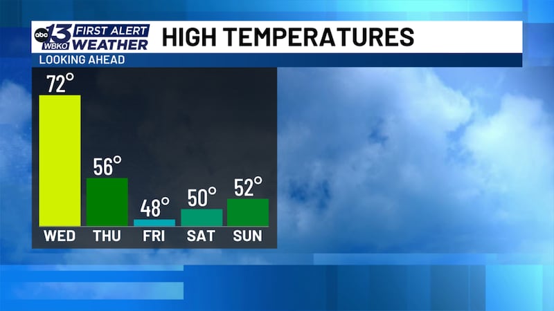
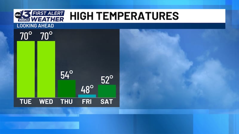
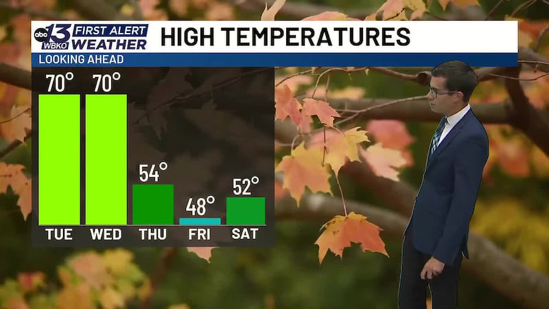
TEMPERATURES PLUMMET: After the front passes, a large mass of cold air will settle in the region, pushing temperatures down over 20 degrees in both the highs and lows. Morning temperatures drop into the upper 20s, and afternoons will stay cool with highs only near 50 degrees.
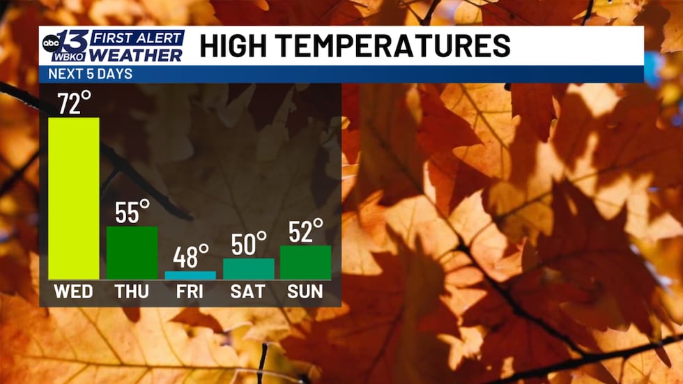
For the weekend, we’ll see mostly sunny skies to bring a bit of warmth, but you’ll want to bundle up for any outdoor plans as temperatures will still be chilly, especially in the shade or after dark.
DOWNLOAD the WBKO First Alert Weather App for the latest on the forecast. Our app is easy to use and free to download!
Click one of the following links to download the app:
Copyright 2026 WBKO. All rights reserved.